Unmanned Survey Solutions (USS)
Unmanned Survey Solutions design, build and operate Unmanned Surface Vessels (USV’s).
Built by surveyors, for surveyors, their modular USV’s offer robust, cost-effective and versatile solutions for surveying in all waters from inland lakes and coastal zones to offshore environments.
Products Include
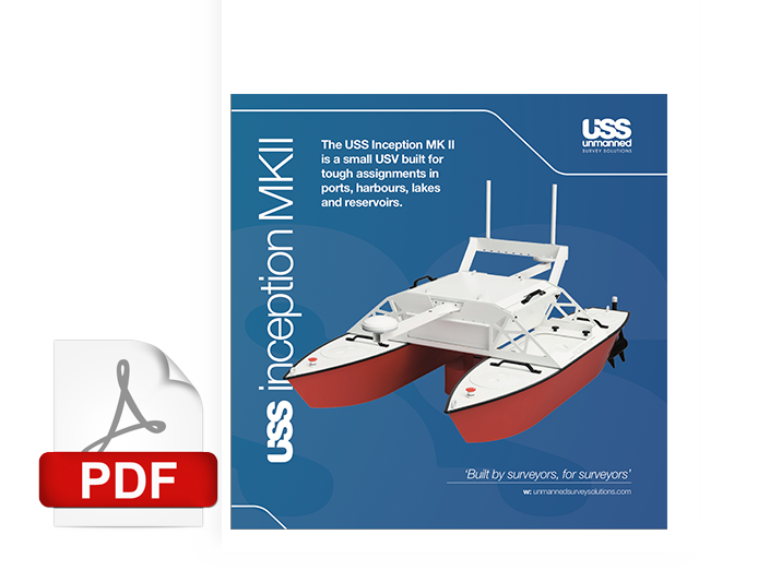
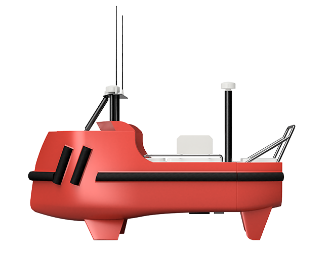
The Inception Class MKI and Mark II USV’s are modular, portable, adaptable and durable.
The Inception Class offer multiple payload pod options, for hydrographic surveying and data acquisition on inland waterways, reservoirs, lakes, marinas, ports and harbours.
These USV’s are operated with remote control capabilities or as autonomous vessels for ultimate line running and survey efficiency.
Cost effective, efficient, and low risk, they exceed industry standards without compromise.
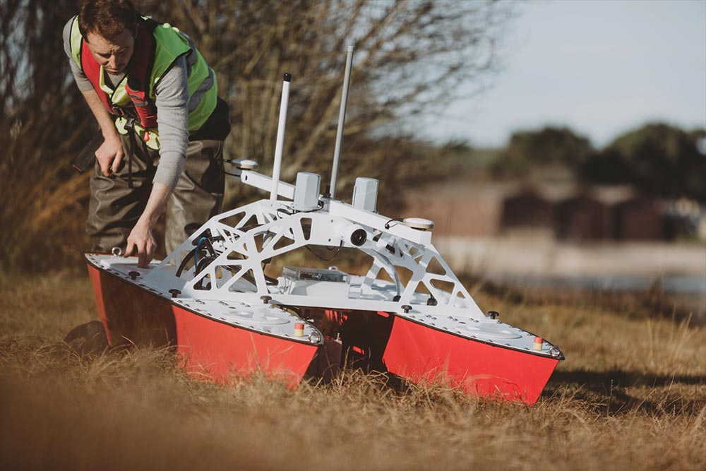
Inception Class Mark I
This hydrographic survey vessel is composed of tough aluminium hulls and weed cutting propellers.
It runs bathymetric surveys in areas where access for a traditional survey vessel is not possible.
Places such as quarry lakes, lagoons, mining ponds and shallow water zones.
Inception Class Mark II
The MKII is ideal for bathymetric surveying in areas where access for a manned survey vessel is difficult. This modular and adaptable USV can be completely customised to client requirements, and is ideal for operation in harbours, rivers, lakes, lagoons, mining ponds and other shallow water zones.
Four standard options to choose from.
Each with different capabilities and payloads
Option 1
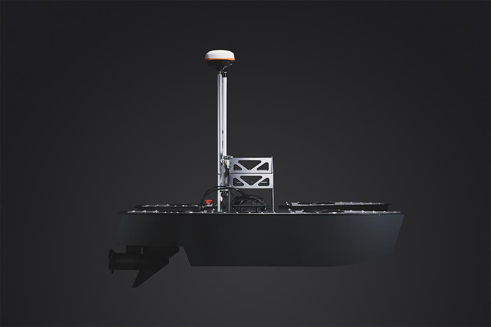
The Inception Mark I with CEE HydroSystems CEEPULSE High Frequency (HF) Single-Beam Echo-Sounder (SBES) and Hemisphere Atlas Link RTK GNSS
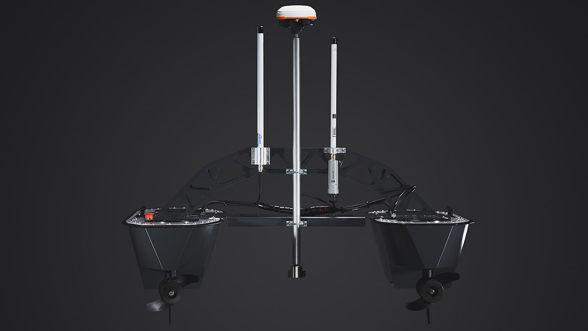
This solution provides single depth points directly under the vessel with positioning accuracy to 10cm.
Results include low-resolution survey data offering generic hydrographic charting capabilities.
Option 2
The Inception Mark II with R2SONIC 2020 Multi-Beam, SBG Ekinox2 Inertial Navigation System (INS) and Trimble RTK GNSS.
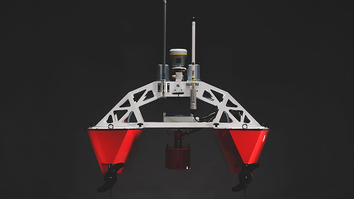
This solution offers 100% coverage of the river, lake or seabed to cm level accuracy.
All three options are offered for sale or for rental with or without an experienced Hydrographic Surveyor/USV operator.
USS can also provide you with a complete Survey Service package.
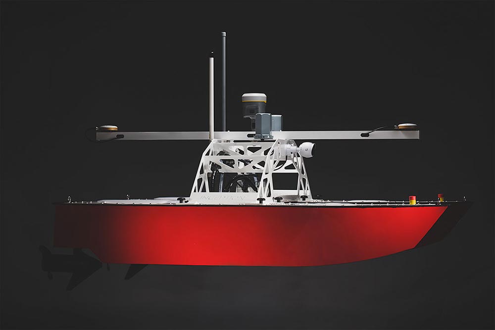
Option 3
The Inception Mark II with CEE HydroSystems
CEESCOPE-USV Dual Frequency (DF) SBES
and imbedded RTK GNSS positioning.
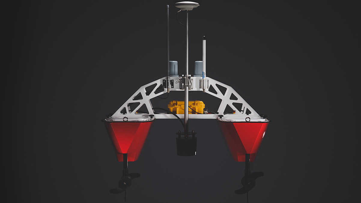
This solution provides two digital depths (one for each frequency – high and low) together with a full sonar trace.
Horizontal positioning is accurate to 1-2cm using a Trimble VRS mobile network or locally installed GNSS base station.
This system also provides vertical control related to your specified reference datum without the need for a tide gauge or similar water lever measuring instrument.
It also allows the user to detect fluid mud layers and soft sediments.
Option 4
The Accession Class USV
The Accession 350 and 425 offers 12 hours continual operation and carries a SONIC 2024, SBG Apogee Navsight, Valeport MiniSVS and SWiFT SVP.
Available with underway SVP profiling capability this USV can be operated as a standalone survey vessel or as a force multiplier with a mothership.
Customers own payload equipment can be integrated for longer duration projects.
USS Survey Service Package
The complete Survey Service package delivers the highest industry standards recognised by IHO/FIG CAT A.
This includes managing all aspects of survey operations from planning, data acquisition, post operation processing to final production of fully referenced datasets with complete reporting to industry standard formats and client-specified criteria.